Question 10
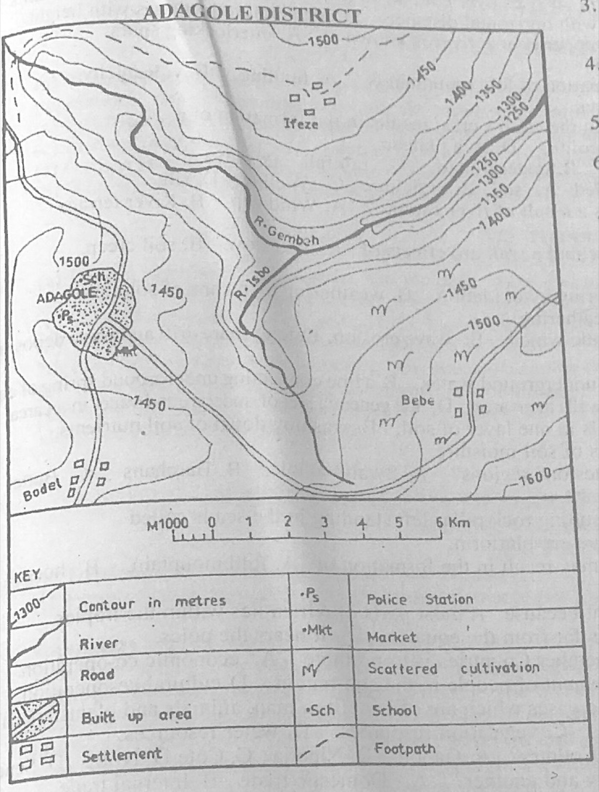
Relief and Map InterpretationStudy the map of ADAGOLE DISTRICT to answer this question. The common modes of transportation in the mapped area are
- A.railway and water.
- B.pipeline and railway.
- C.road and water.
- D.air and water.
Show the answer and explanation
Answer: C (road and water.)
Explanation
The map shows roads and rivers; there is no railway, pipeline or airport.