Question 9
Relief and Map InterpretationStudy the map of ADAGOLE DISTRICT to answer this question. Which of the following statements is true about the drainage of the mapped area?
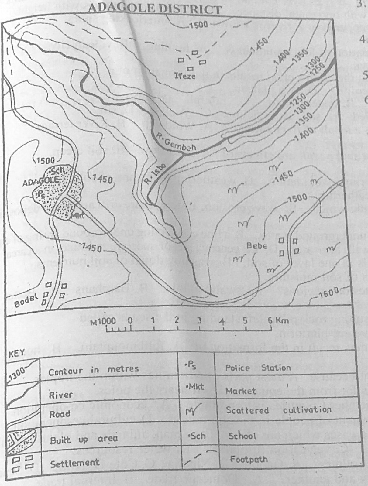
- A.The watershed from which the rivers take their sources is in the North West.
- B.R. Isbo and R. Gembeh are the two rivers that drain the district.
- C.R. Gembeh has many distributaries.
- D.An oxbow lake has been formed at the point of intersection of R. Isbo and R. Gembeh.
Show the answer and explanation
Answer: B (R. Isbo and R. Gembeh are the two rivers that drain the district.)
Explanation
Only two rivers, R. Isbo and R. Gembeh, are shown draining the district.