Question 8
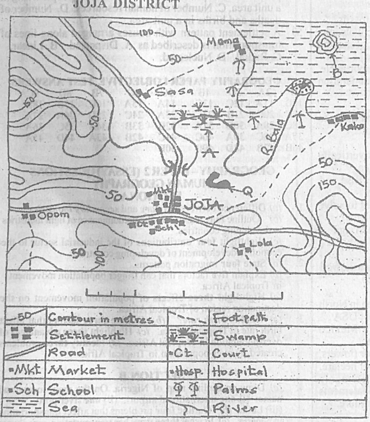
Relief and Map InterpretationStudy the map of JOJA DISTRICT to answer this question. The feature marked Q on the mapped area can be described as
- A.meander.
- B.levee.
- C.elbow of capture.
- D.ox-bow lake.
Show the answer and explanation
Answer: D (ox-bow lake.)
Explanation
Q points to a curved, horseshoe-shaped lake cut off beside the stream: an ox-bow lake.