Question 7
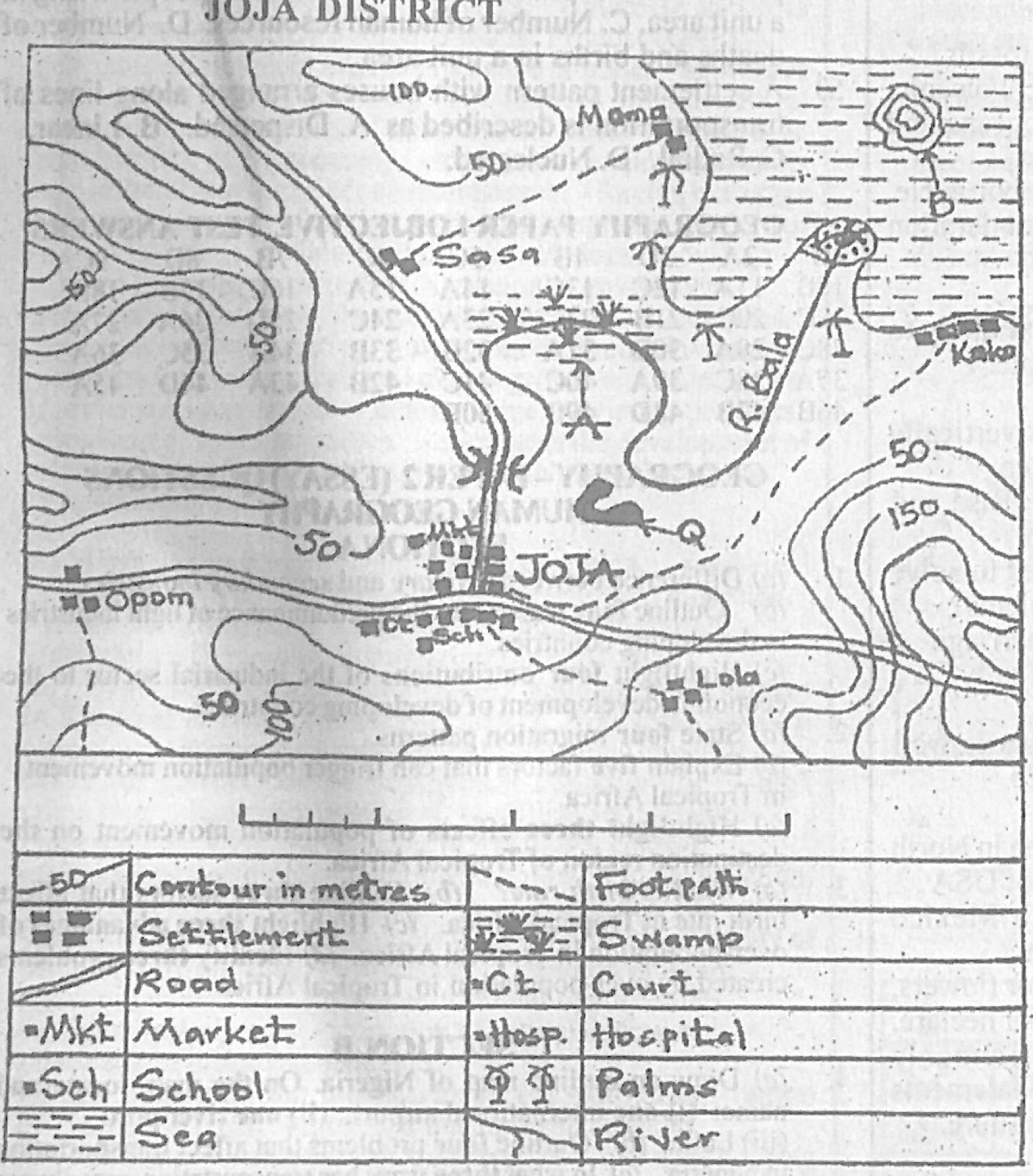
Relief and Map InterpretationStudy the map of JOJA DISTRICT to answer this question. Which part of the mapped area can coastal fishing be practiced?
- A.South western.
- B.South eastern.
- C.North eastern.
- D.North western.
Show the answer and explanation
Answer: C (North eastern.)
Explanation
The sea (with the island and the mouth of River Bala) lies in the north-east of the map, so coastal fishing is there.