Question 11
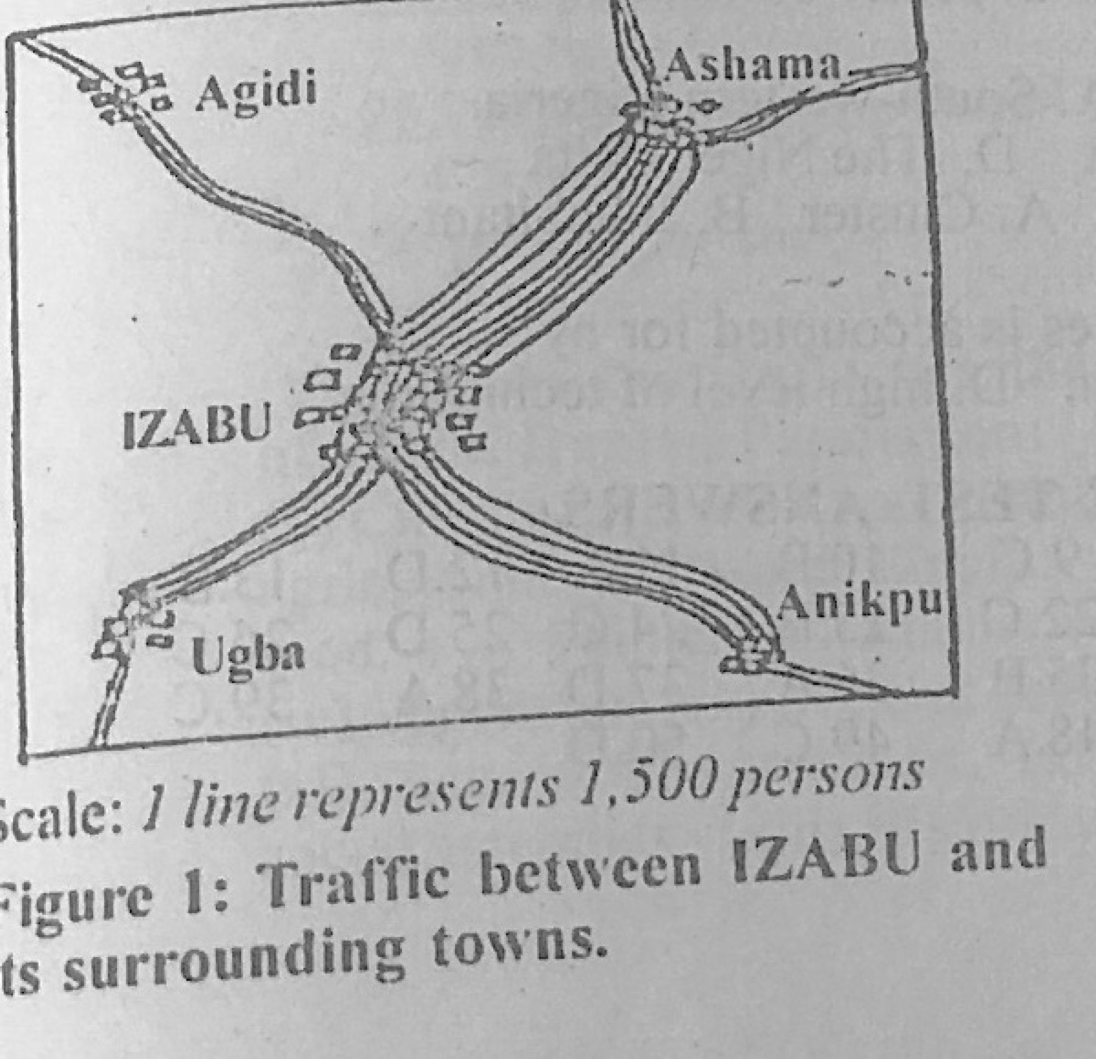
Statistical Maps and DiagramsFigure 1 shows the volume and direction of passenger traffic between IZABU town and its surrounding towns in the year 2001 (scale: 1 line represents 1,500 persons). Use it to answer this question. Which of the following statistical methods is represented above?
- A.Dot map
- B.Isohaline map
- C.Flow map
- D.Barchart
Show the answer and explanation
Answer: C (Flow map)
Explanation
Bands of lines between towns, whose width shows the volume of movement, form a flow map.