Question 5
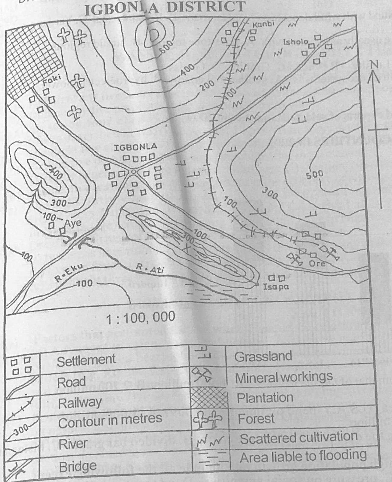
Relief and Map InterpretationStudy the map of IGBONLA DISTRICT (scale 1:100,000) to answer this question. The growth of IGBONLA settlement is as a result of its location as the
- A.most central position on the map.
- B.largest undulating terrain available for agricultural activities.
- C.most apparently secured place in time of war.
- D.meeting point of different route ways.
Show the answer and explanation
Answer: D (meeting point of different route ways.)
Explanation
Four roads meet at IGBONLA, so it grew as a nodal settlement.