Question 4
Relief and Map InterpretationStudy the map of IGBONLA DISTRICT (scale 1:100,000) to answer this question. The lower banks of River Ati could best be used for the cultivation of
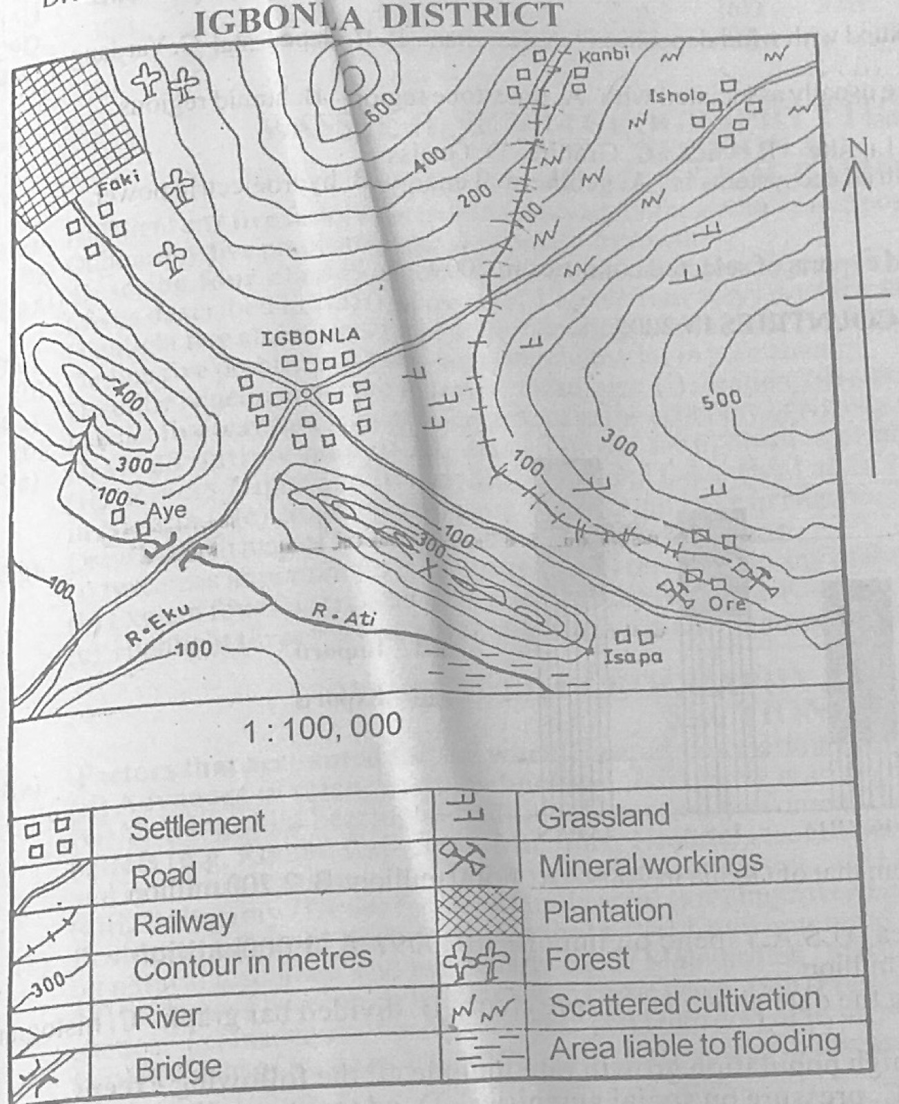
- A.coco yam.
- B.wheat.
- C.rice.
- D.yam.
Show the answer and explanation
Answer: C (rice.)
Explanation
The lower banks of River Ati are an area liable to flooding, which suits swamp rice.