Question 5
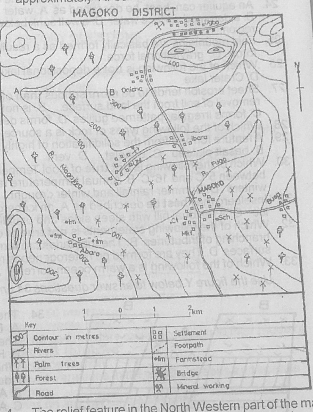
Relief and Map InterpretationStudy the map of MAGOKO DISTRICT to answer this question. The feature marked A - B is called a
- A.headland
- B.ridge
- C.spur
- D.cliff
Show the answer and explanation
Answer: C (spur)
Explanation
Between A and B the contours bend outwards from the higher ground, forming a tongue of land sloping down: a spur.