Question 4
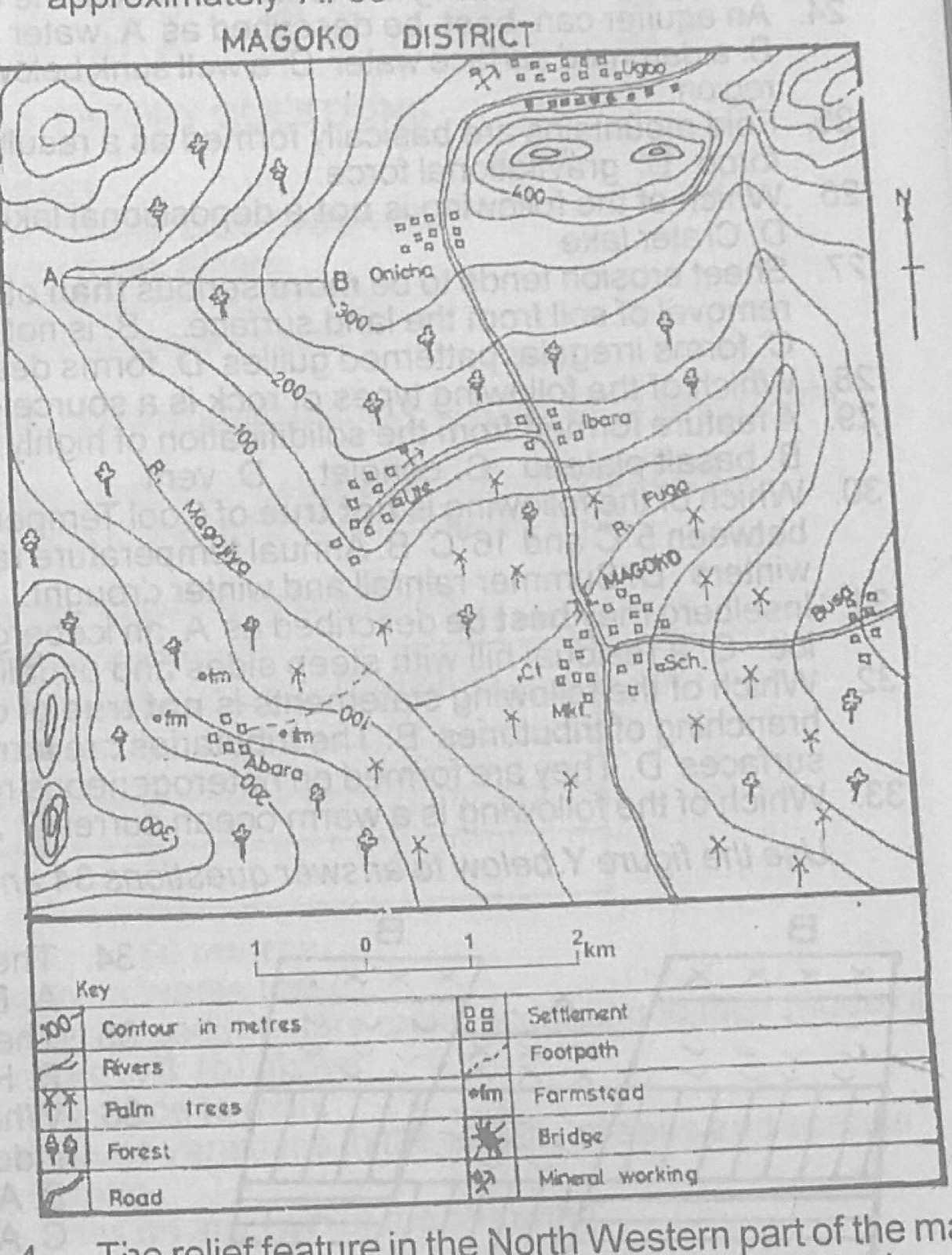
Relief and Map InterpretationStudy the map of MAGOKO DISTRICT to answer this question. The relief feature in the North Western part of the map is called a
- A.ridge
- B.plateau
- C.conical hill
- D.dissected highland
Show the answer and explanation
Answer: C (conical hill)
Explanation
In the north-west the contours form small closed rings one inside another: a conical hill.