Question 2
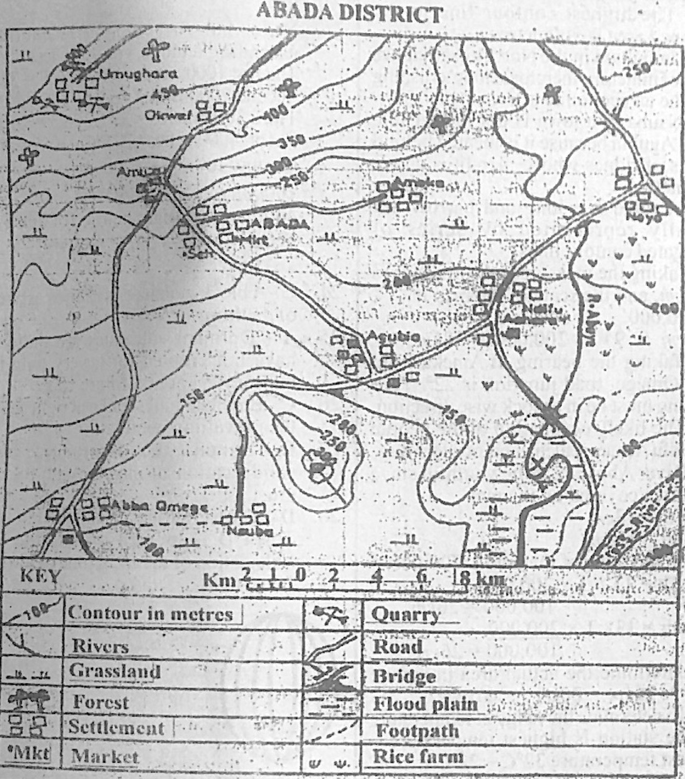
Relief and Map InterpretationStudy the map of ABADA DISTRICT to answer this question. What is the highest contour line in the mapped area?
- A.600 metres
- B.500 metres
- C.400 metres
- D.300 metres
Show the answer and explanation
Answer: B (500 metres)
Explanation
The highest labelled contour, near Umughara in the north-west, is 500 m.