Question 13
Statistical Maps and DiagramsFigure 1 represents the export of rice by four regions in Country XX in the year 2009. One dot represents 20,000 tonnes of exported rice was used as the scale of the dot map. Study the dot map to answer this question. The total export of rice for regions R and T is
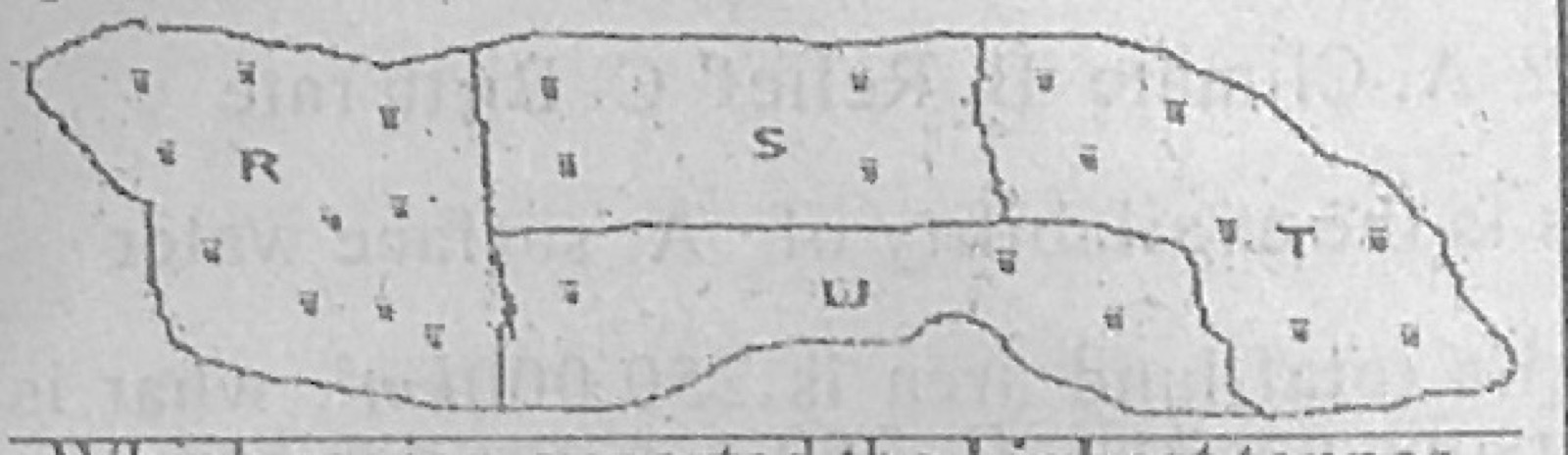
- A.180,000 tonnes
- B.210,000 tonnes
- C.260,000 tonnes
- D.340,000 tonnes
Show the answer and explanation
Answer: D (340,000 tonnes)
Explanation
R (10 dots) + T (7 dots) = 17 dots × 20,000 = 340,000 tonnes.