Question 5
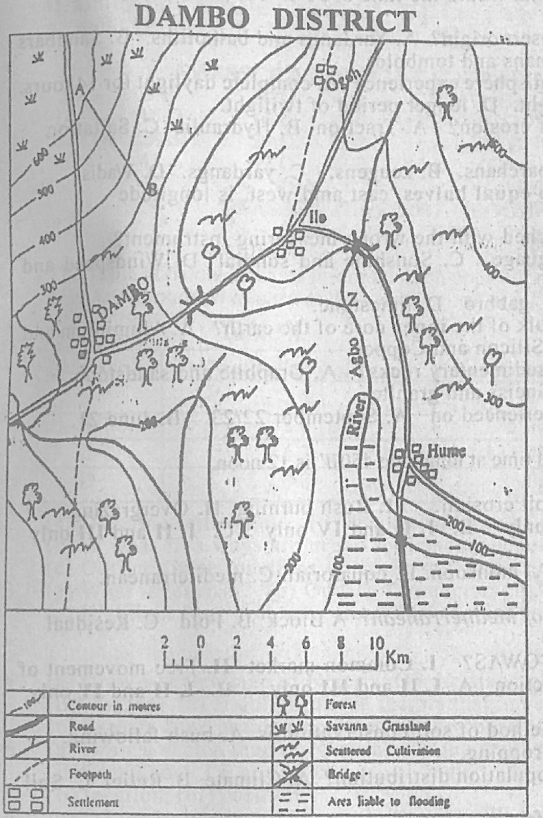
Relief and Map InterpretationStudy the map of DAMBO DISTRICT to answer this question. The highest point of the mapped area is found in the
- A.southwest
- B.southeast.
- C.northeast.
- D.northwest.
Show the answer and explanation
Answer: D (northwest.)
Explanation
The 500 m and 600 m contours are in the north-west corner; the land falls to 100 m in the south-east.