Question 5
Relief and Map InterpretationStudy the map of NITY DISTRICT (scale 1:50,000) to answer this question. The highest elevation in the mapped area is approximately
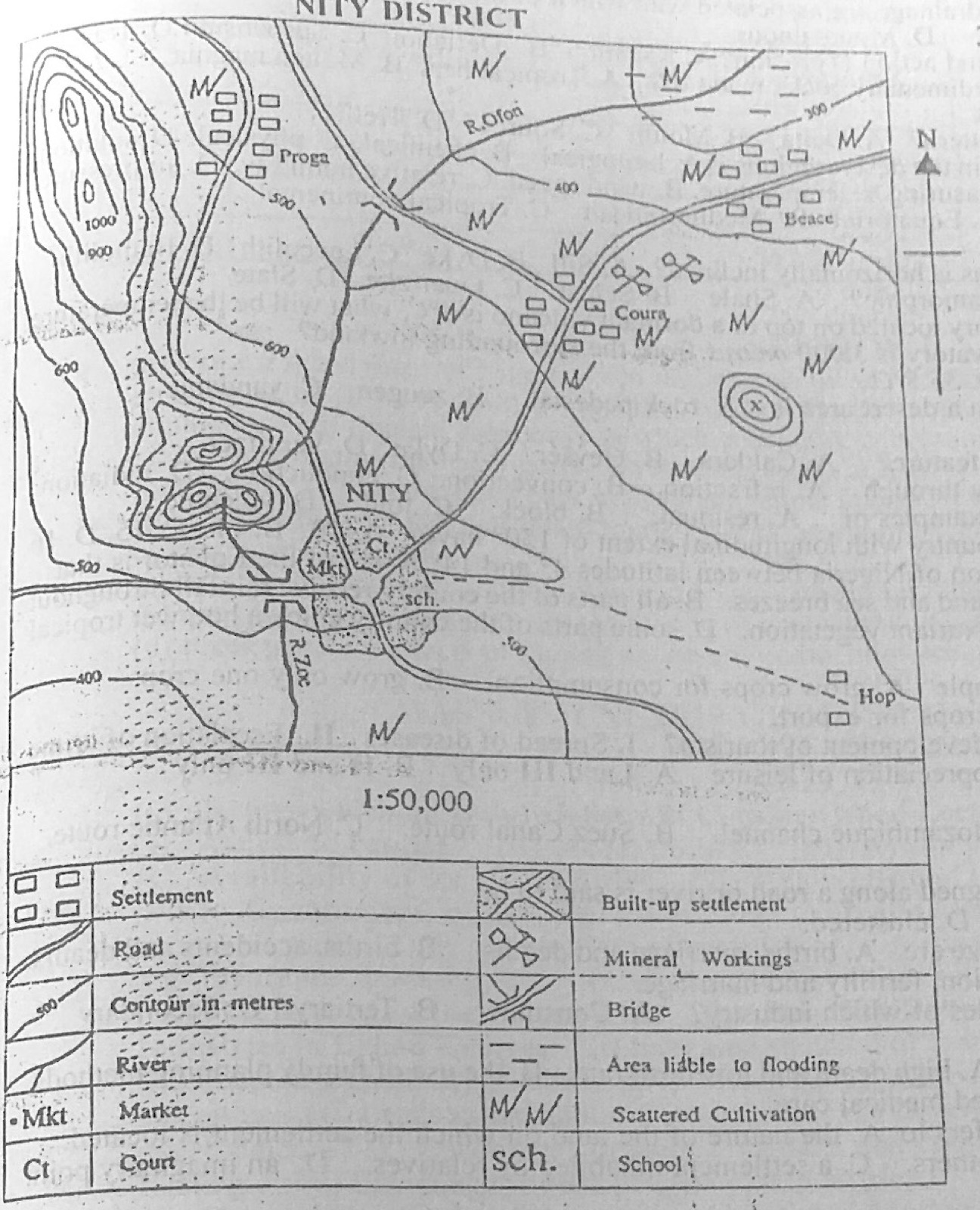
- A.800 m.
- B.900 m.
- C.1250 m.
- D.1400 m.
Show the answer and explanation
Answer: C (1250 m.)
Explanation
The ridge in the north-west has closed contours above the 1000 m line, so its top is over 1,000 m: about 1,250 m among the options.