Question 9
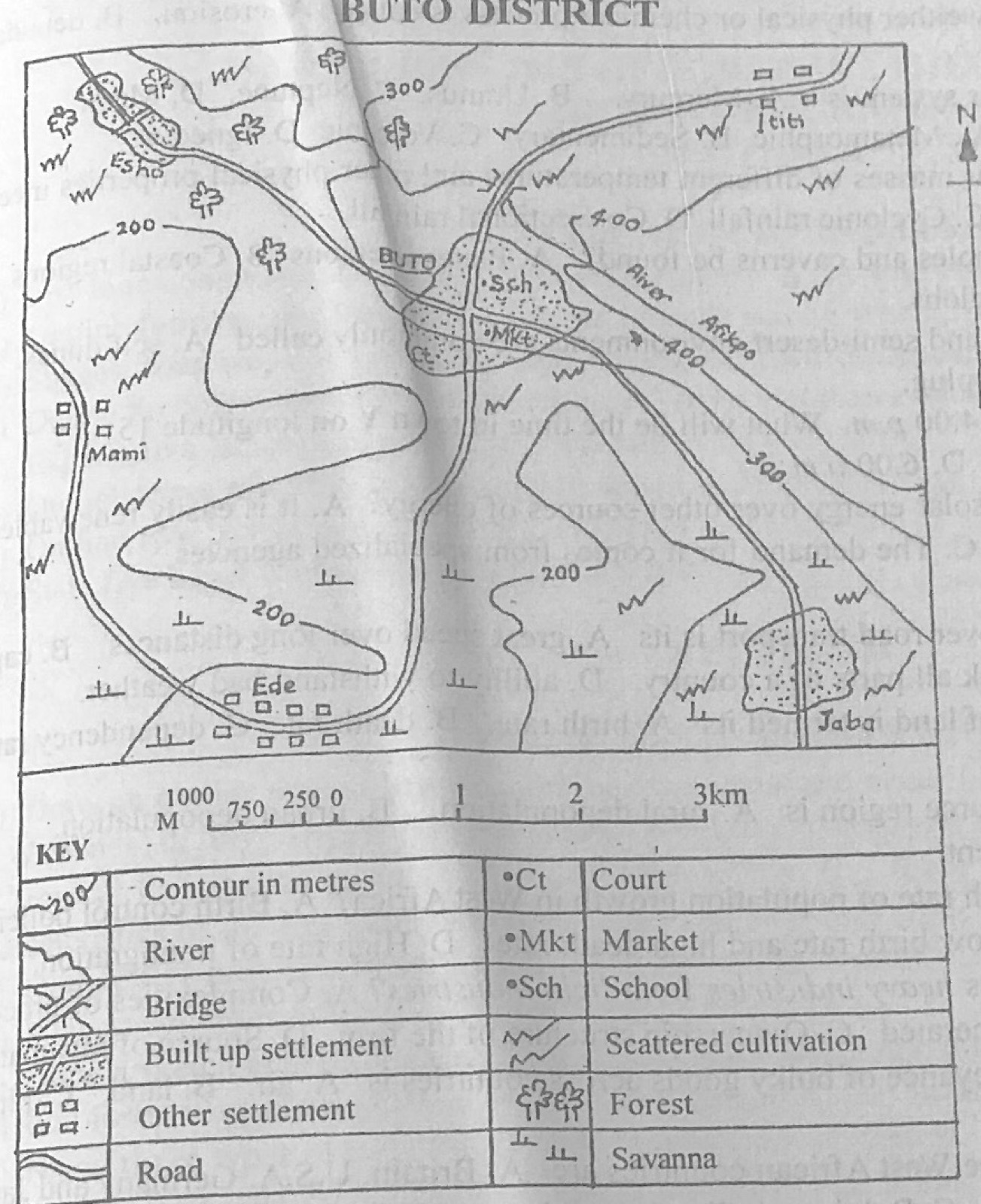
Relief and Map InterpretationStudy the map of BUTO DISTRICT to answer this question. Which of the following modes of transport is commonly used in the mapped area?
- A.River
- B.Road
- C.Rail
- D.Air
Show the answer and explanation
Answer: B (Road)
Explanation
Only roads are shown linking the settlements.