Question 10
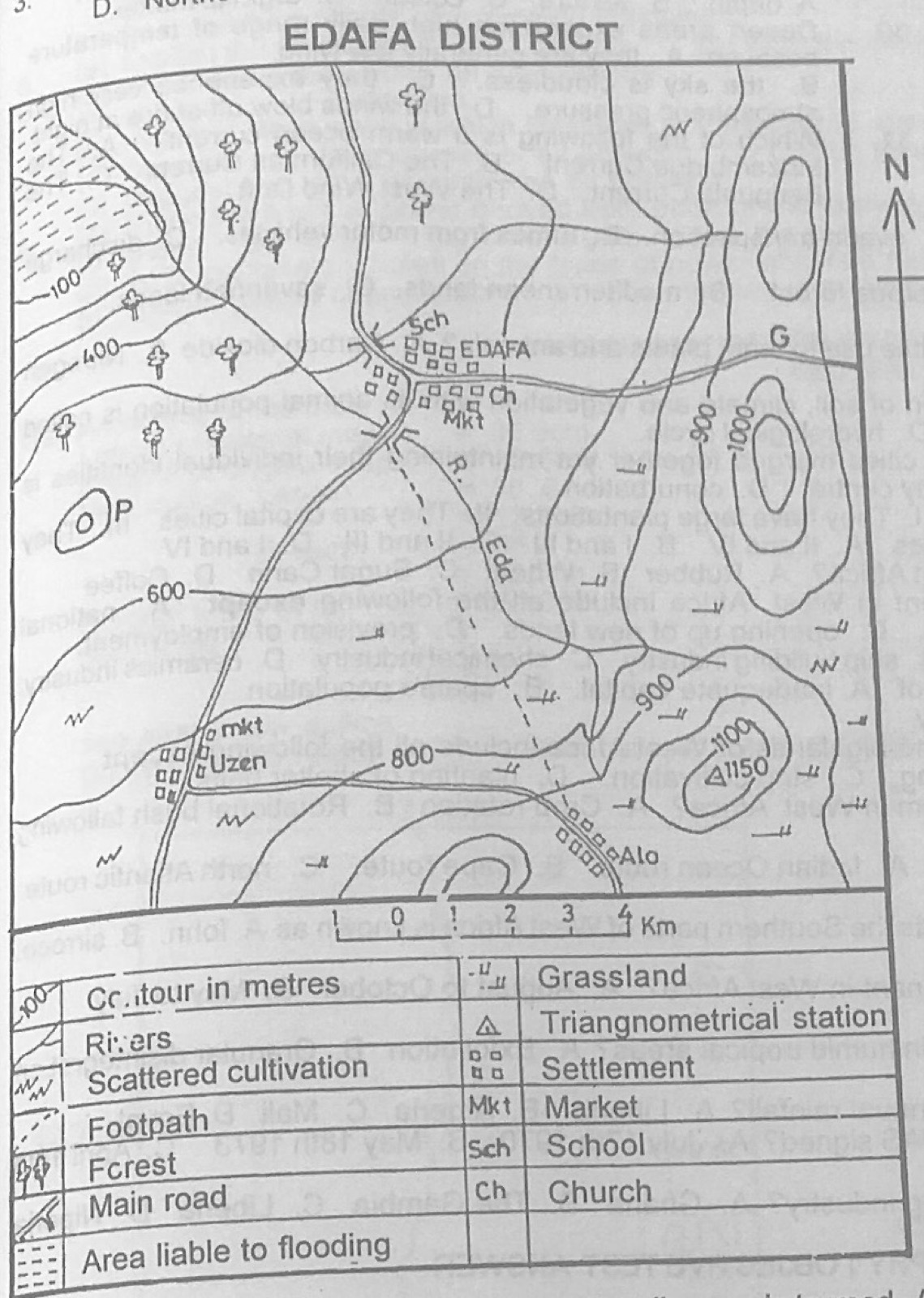
Relief and Map InterpretationStudy the map of EDAFA DISTRICT to answer this question. The South Eastern part of the mapped area is suitable for
- A.lumbering.
- B.mining.
- C.animal rearing.
- D.cement manufacturing.
Show the answer and explanation
Answer: C (animal rearing.)
Explanation
The south-east is high land covered with grassland symbols, good for grazing animals.