Question 5
Relief and Map InterpretationStudy the map of OFOT DISTRICT to answer this question. The long stretch of highland in the northern part of the map is a
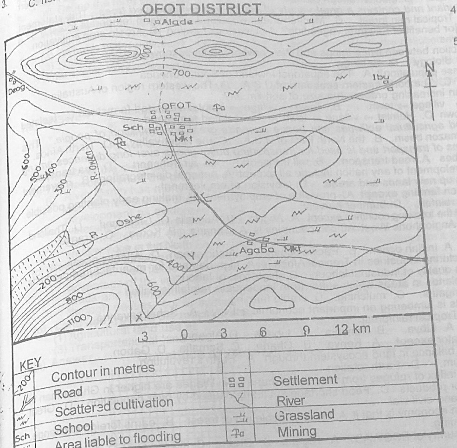
- A.caldera.
- B.geyser.
- C.ridge.
- D.plateau.
Show the answer and explanation
Answer: C (ridge.)
Explanation
The long, narrow belt of high ground with closed contours along the north is a ridge.