Question 9
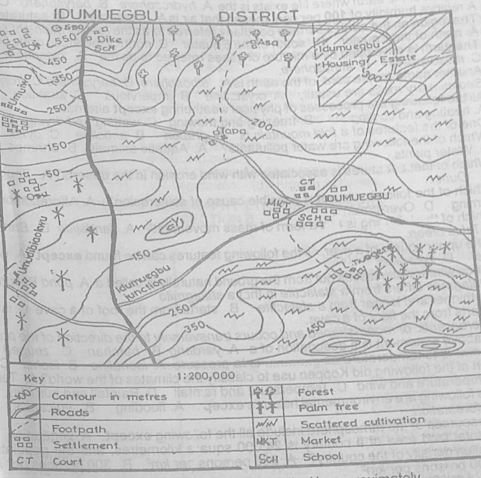
Relief and Map InterpretationStudy the map of IDUMUEGBU DISTRICT to answer this question. The feature marked Y can best be described as a/an
- A.saddle
- B.knoll
- C.escarpment
- D.ridge.
Show the answer and explanation
Answer: B (knoll)
Explanation
Y is a small hill shown by a few tiny closed contours: a knoll.