Question 6
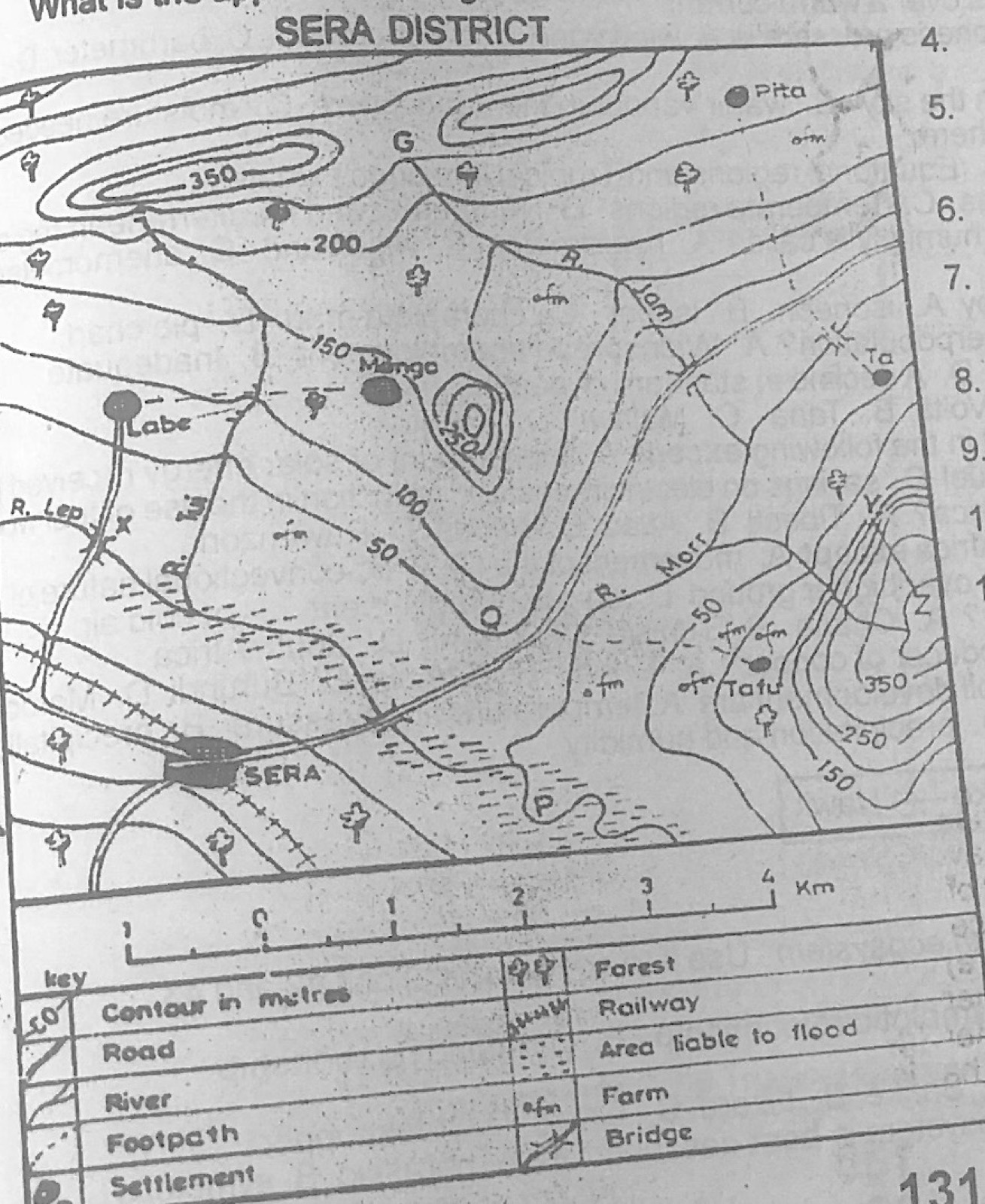
Relief and Map InterpretationStudy the map of SERA DISTRICT to answer this question. SERA may be described as a
- A.fishing town
- B.coastal town
- C.nodal town
- D.gap town.
Show the answer and explanation
Answer: C (nodal town)
Explanation
Several roads and the railway meet at Sera, making it a nodal town.