Question 4
Relief and Map InterpretationStudy the map of SERA DISTRICT to answer this question. The highest point on the map is a little above
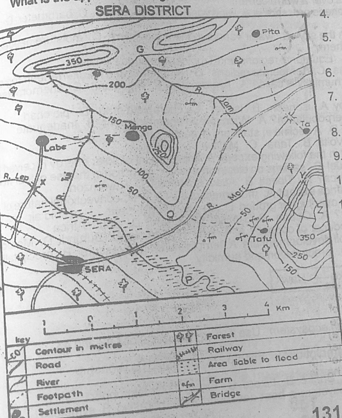
- A.250 m
- B.300 m
- C.400 m
- D.500 m.
Show the answer and explanation
Answer: C (400 m)
Explanation
The hill in the south-east has closed contours inside the 350 m line (interval 50 m), so its top is a little above 400 m.