Question 1
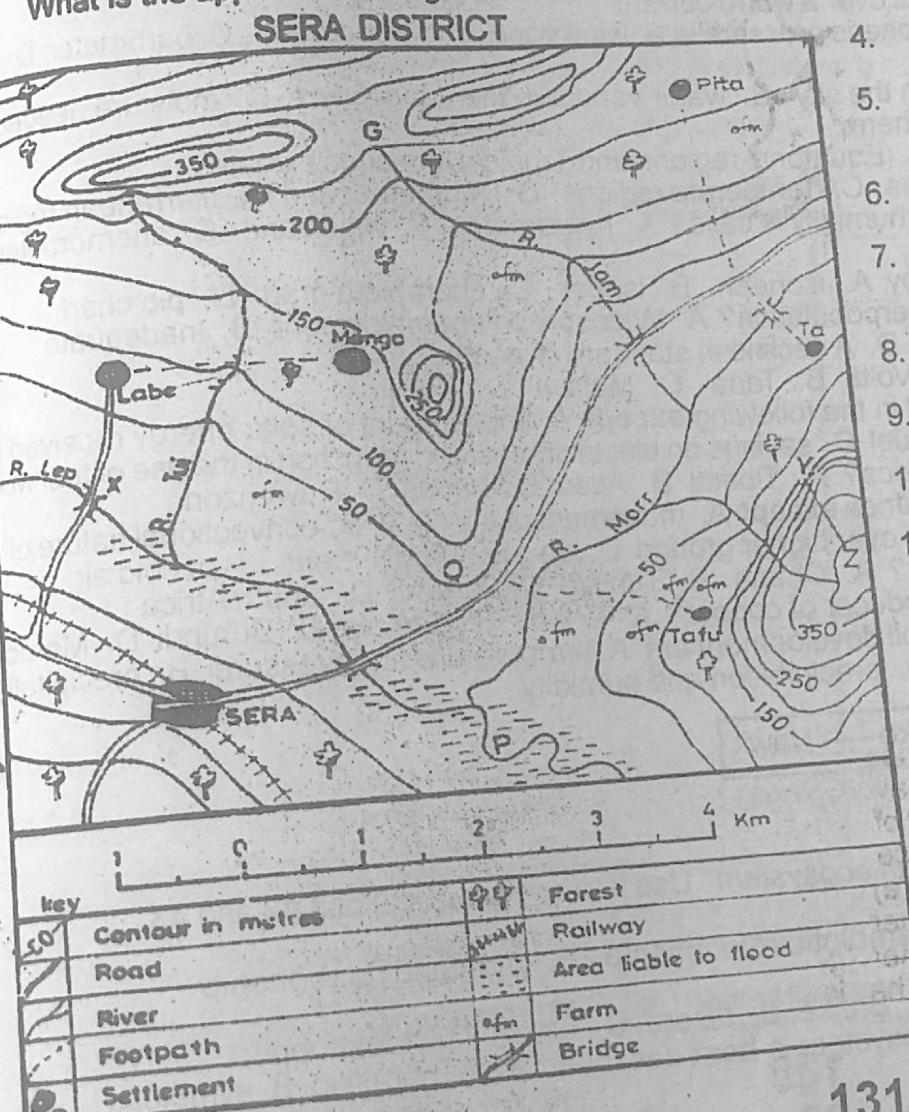
Relief and Map InterpretationStudy the map of SERA DISTRICT to answer this question. The feature marked G on the map represents a
- A.cuesta
- B.mountain
- C.slope
- D.saddle.
Show the answer and explanation
Answer: D (saddle.)
Explanation
G is a low dip on the high ground between two hill tops (both ringed by the 350 m contour): a saddle.