Question 7
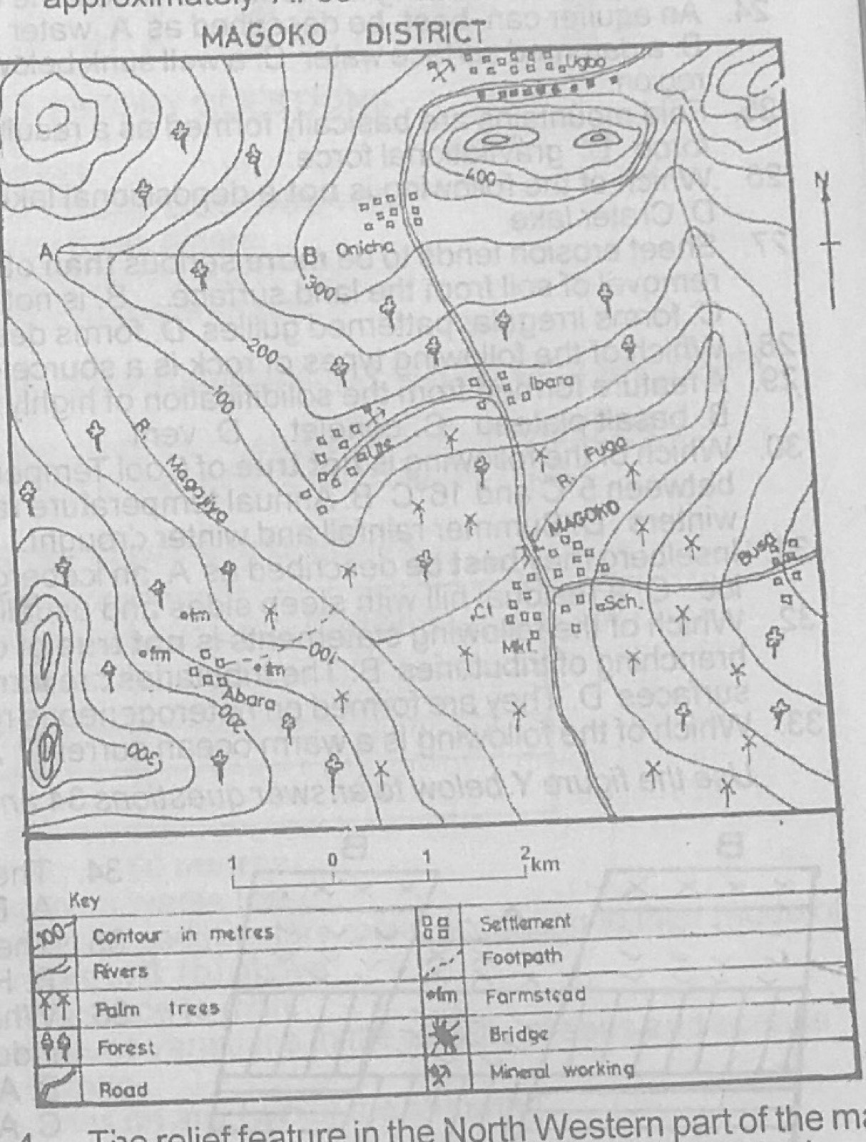
Relief and Map InterpretationStudy the map of MAGOKO DISTRICT to answer this question. Ute and Ugbo can best be described as
- A.farm setilements
- B.mining settlements
- C.port settlements
- D.fishing settlements
Show the answer and explanation
Answer: B (mining settlements)
Explanation
Mineral working symbols are printed beside both Ute and Ugbo.