Question 10
Map Scale, Distance and DirectionStudy the map of MAGOKO DISTRICT to answer this question. The total area covered by the map is approximately
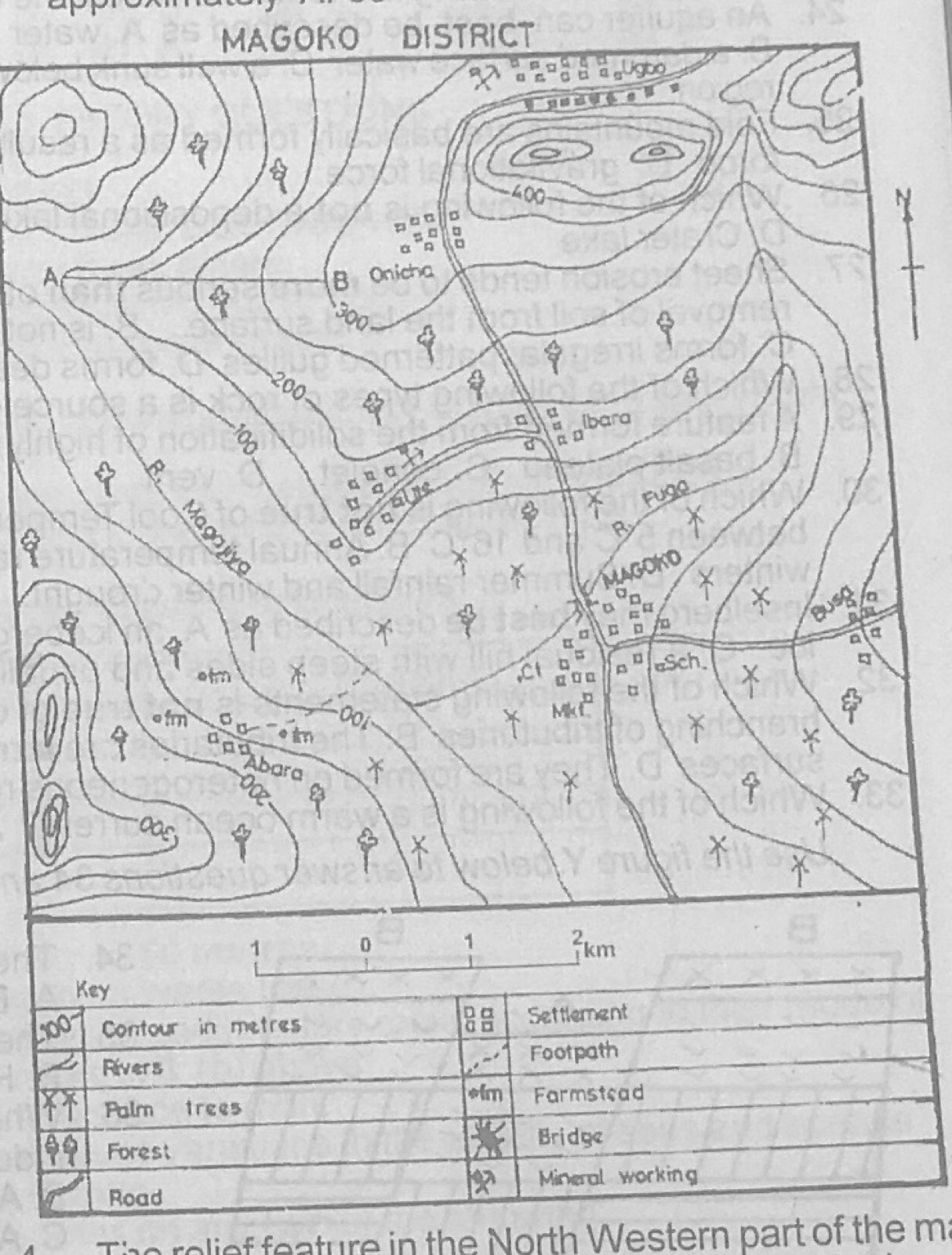
- A.250.00 km²
- B.120.25km²
- C.90.45 km²
- D.66.25 km²
Show the answer and explanation
Answer: D (66.25 km²)
Explanation
Measure the length and width of the map frame against the linear scale and multiply them.