Question 10
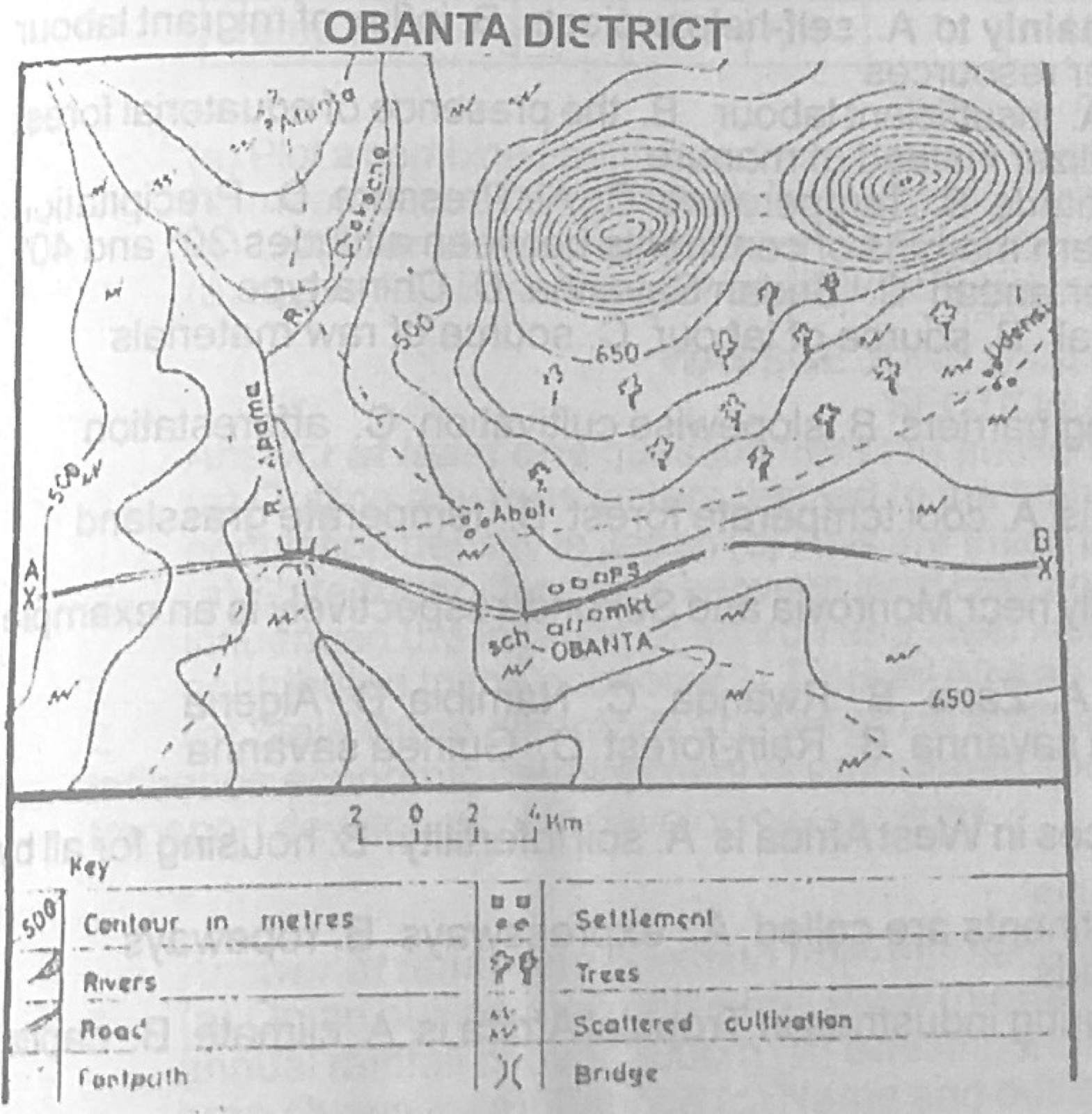
Relief and Map InterpretationUse the map of OBANTA DISTRICT to answer this question. The footpaths are mainly for
- A.mining
- B.lumbering
- C.farming
- D.hunting
Show the answer and explanation
Answer: C (farming)
Explanation
The footpaths lead out from the settlements to the areas of scattered cultivation, so they are farm paths.