Question 9
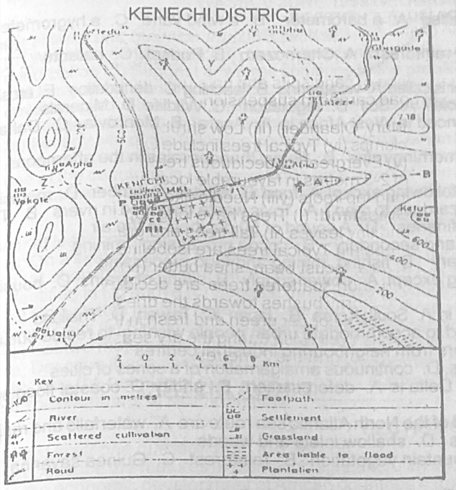
Relief and Map InterpretationUse the map of KENECHI district to answer this question. Which crop is best suited in the south-eastern corner of the area shown on the map?
- A.Cotton
- B.Tea
- C.Cocoa
- D.Rice
Show the answer and explanation
Answer: D (Rice)
Explanation
The south-east is low land marked 'area liable to flood'; waterlogged land suits rice.