Question 6
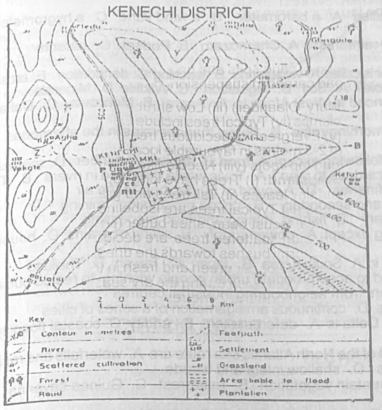
Relief and Map InterpretationUse the map of KENECHI district to answer this question. The feature marked Z on the western part of the map near Vokote is called a
- A.ridge
- B.scarp
- C.pass
- D.gap
Show the answer and explanation
Answer: C (pass)
Explanation
Z is a low point between two hills on the western high ground, used as a way through: a pass.