Question 8
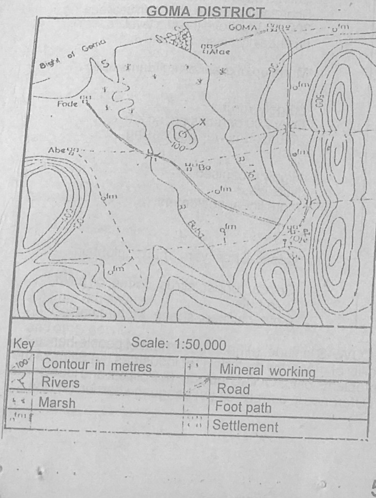
Relief and Map InterpretationUse the map of GOMA DISTRICT to answer this question. Fode may best be described as
- A.a ferry point
- B.a river port
- C.a confluence town
- D.a route terminus
- E.an administrative capital
Show the answer and explanation
Answer: D (a route terminus)
Explanation
The road from the interior ends at Fode on the coast, so Fode is a route terminus.