Question 4
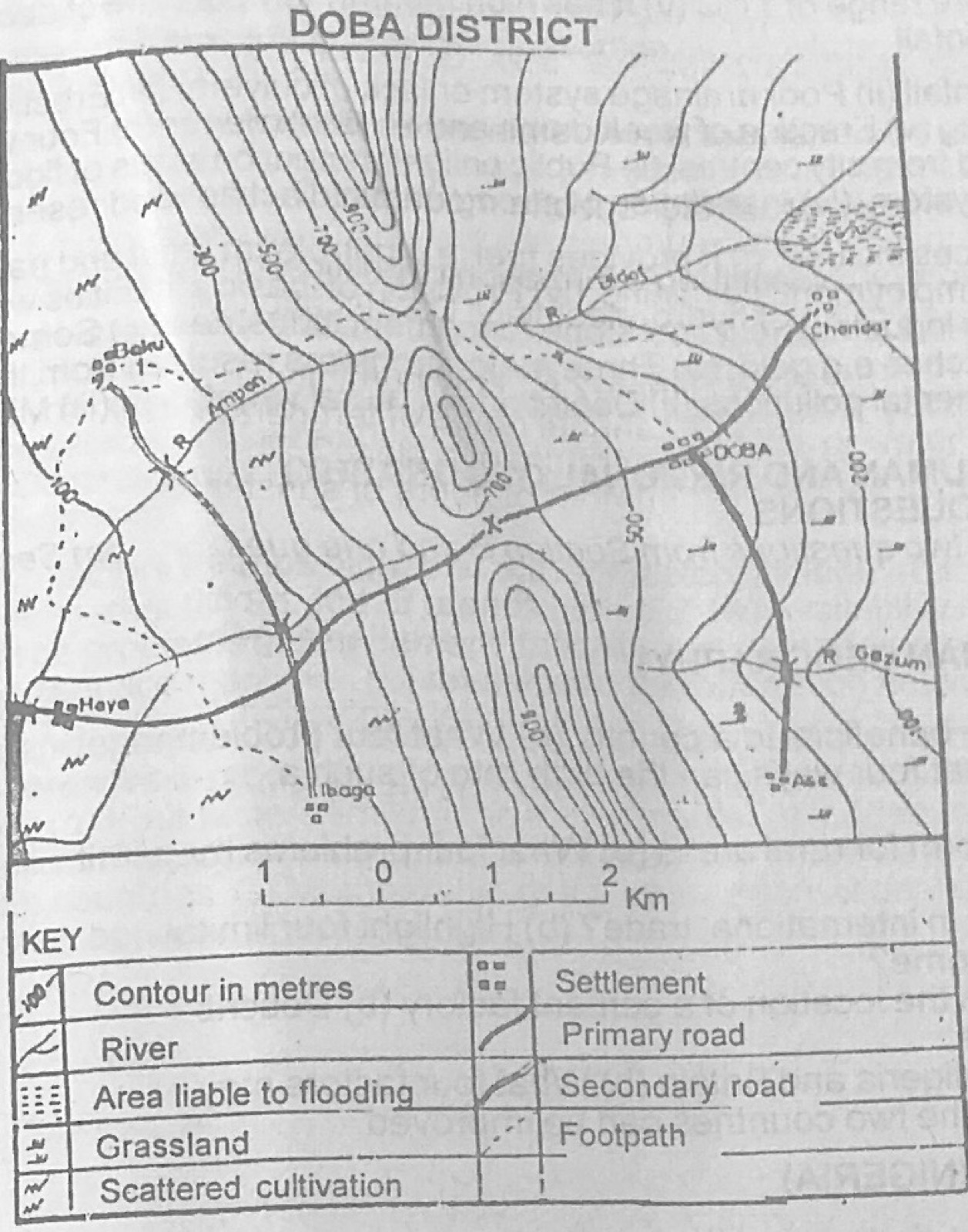
Relief and Map InterpretationUse the map of DOBA DISTRICT to answer this question. The feature marked X is best described as a
- A.pass
- B.depression
- C.spur
- D.valley
- E.plateau
Show the answer and explanation
Answer: A (pass)
Explanation
X is the low point between two higher parts of the ridge, where the road crosses: a gap or pass.