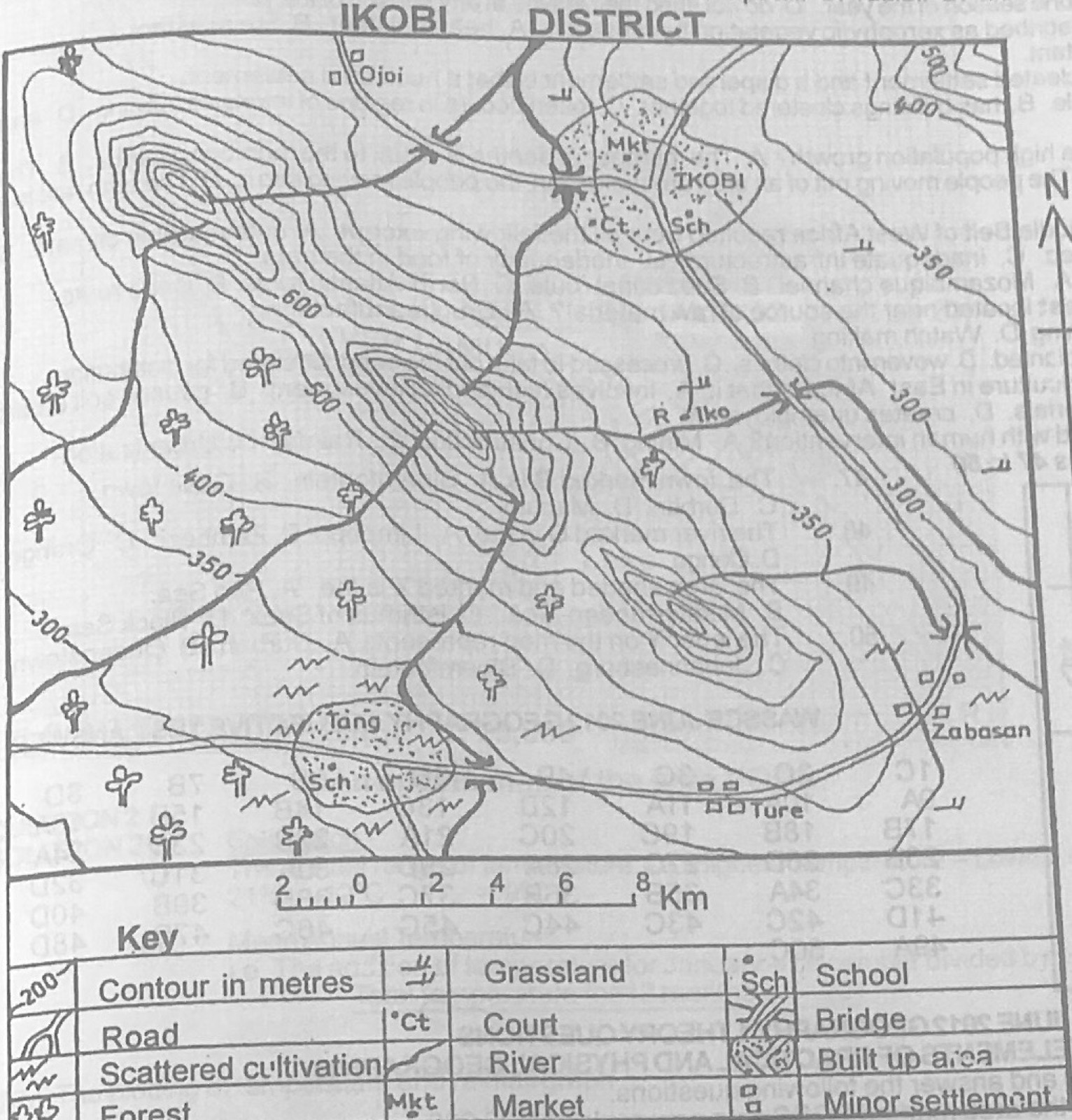
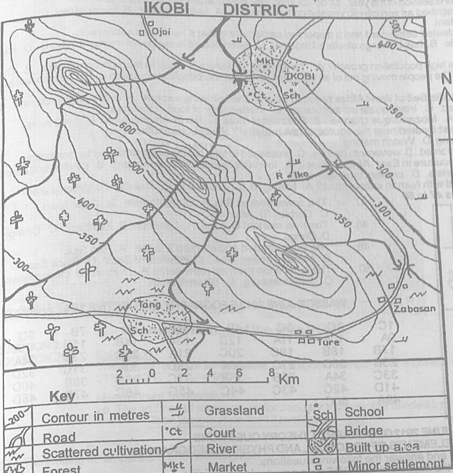
(a) Highlight any four differences between urban and rural settlements (b) Outline any four favourable conditions for the growth of settlements
Show the model answer
Model answer
(a) Urban: large population, rural: small; urban: mainly secondary and tertiary jobs, rural: mainly primary (farming, fishing, lumbering); urban: many amenities (pipe-borne water, electricity, hospitals), rural: few; urban: dense, tall buildings with planned layout, rural: scattered simple buildings; urban: heterogeneous people, rural: homogeneous; urban: has a central business district; urban: higher cost of living, crime and pollution. (b) Good water supply; fertile land; gentle, well-drained relief; good climate; security/defence sites; nodal location on routes; mineral resources; harbours and coastal sites; government policy (capital); availability of social amenities.
(a) State three advantages and two disadvantages of air transportation. (b) Highlight five roles of road transportation in the promotion of economic development.
Show the model answer
Model answer
(a) Advantages: fastest means of transport; crosses mountains, seas and forests; good for perishable, light and valuable goods and mail; useful in emergencies; links distant countries; comfortable. Disadvantages: very expensive (fares, aircraft, airports); carries limited loads, unsuitable for bulky goods; affected by bad weather; accidents are usually fatal; needs highly skilled staff; noise pollution. (b) Moves goods and people; links rural producing areas to markets and towns; opens up new areas for development; provides employment (drivers, mechanics, traders); door-to-door service; feeds other modes (ports, railways, airports); promotes trade and national integration; government revenue (licences, tolls); encourages tourism.
(a) Draw a sketch map of Nigeria. On the map, show and name: (i) a delta; (ii) a man-made lake; (iii) a confluence town; (iv) the Jos Plateau. (b) Outline any three physical factors that limit the use of rivers for transportation in Nigeria. (c) Highlight three possible solutions to the limiting factors mentioned in 4(b) above.
Show the model answer
Model answer
(a) Map: Niger Delta (south); Kainji Lake on the Niger (west), or Shiroro/Jebba; Lokoja at the Niger-Benue confluence; Jos Plateau (centre). (b) Seasonal changes in volume (low water in the dry season); rapids, waterfalls and rocky outcrops; sandbars and silting; shallow and winding channels; water weeds (water hyacinth); floods; many rivers flow north-south, not across the country. (c) Dredging and channelisation; building dams and locks to regulate flow; clearing weeds; removing rocks/blasting rapids; building canals and river ports; afforestation to reduce silting.
(a) Draw an outline map of Nigeria. On the map, show and name: (i) Abuja; (ii) three savanna vegetation belts. (b) State four ways in which the forest vegetation of Nigeria contributes to her economy. (c) Highlight any two problems that hinder the exploitation of forest vegetation in Nigeria.
Show the model answer
Model answer
(a) Map: Abuja in the centre; Guinea savanna (middle belt), Sudan savanna (north), Sahel savanna (far north-east/north); key. (b) Timber for building, furniture and export; raw materials for industries (plywood, paper, matches); fuelwood and charcoal; employment (lumbering, sawmills, forest guards); foreign exchange; food, medicinal plants and game; tourism; protects soil and climate. (c) Scattered trees of one species; heavy hardwoods; dense undergrowth and poor access roads; swampy ground; lack of capital and modern equipment; deforestation and illegal felling; tropical diseases and heavy rain.
Explanation
Show the savanna belts in the right order north-south.
(a) Highlight five problems of development of the Cross River Basin. (b) In what five ways can these problems be solved?
Show the model answer
Model answer
(a) Heavy rainfall causing floods and soil erosion (gullies); swampy and waterlogged land; poor roads and bridges; dense forest hard to clear; poor soils (leached, acidic) in places; tsetse and other diseases; inadequate capital and industries; poor social amenities; youth unemployment and migration; border problems. (b) Flood and erosion control (dams, drainage, afforestation); build roads and bridges; River Basin Development Authority projects (irrigation, fishing); provide amenities (electricity, schools, hospitals); establish industries using local resources; credit and modern inputs to farmers; tourism development (Obudu); disease control.
(a) Draw a map of West Africa. On it, show and name: (i) one French-speaking country; (ii) one English-speaking country; (iii) the capitals of the countries shown in 7(a)(i) and (ii) above. (b) State three objectives of the Economic Community of West African States. (c) Highlight three problems hindering the achievement of the objectives of the Economic Community of West African States (ECOWAS).
Show the model answer
Model answer
(a) Map of West Africa with e.g. Togo (Lomé) or Senegal (Dakar) or Niger (Niamey) as French-speaking; Nigeria (Abuja) or Ghana (Accra) as English-speaking. (b) Promote economic co-operation and integration; promote trade among member states (remove tariffs); free movement of people, goods and services; joint development of transport and communication; common currency; raise living standards; maintain peace and security. (c) Similar primary products (little to trade); language and currency differences; political instability and coups; fear of domination by big members (Nigeria); loyalty to former colonial powers and other blocs; non-payment of dues; poor transport links; smuggling and border closures; differing political ideologies.
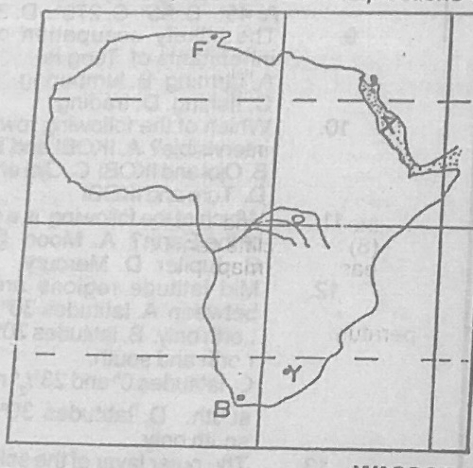
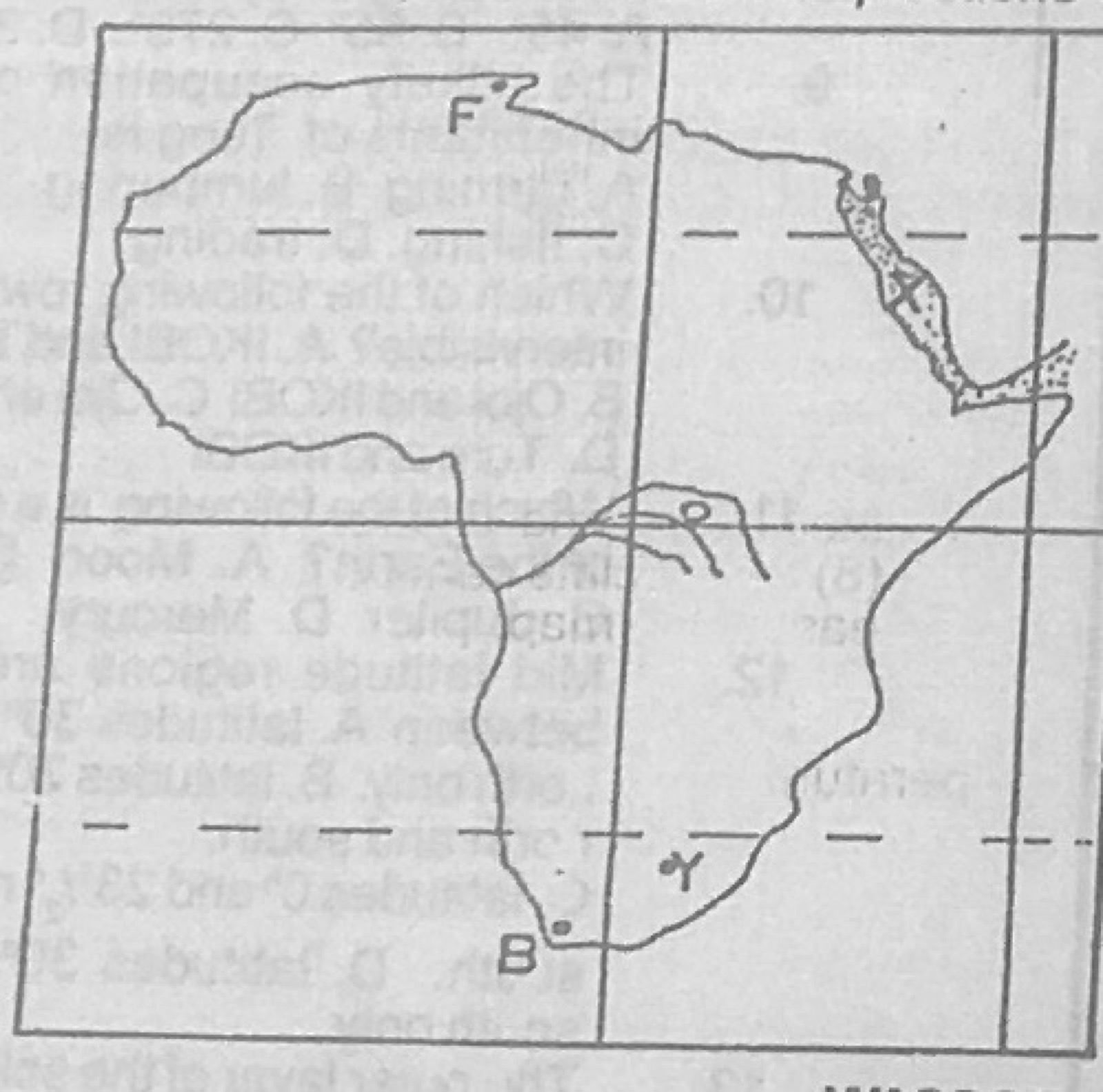
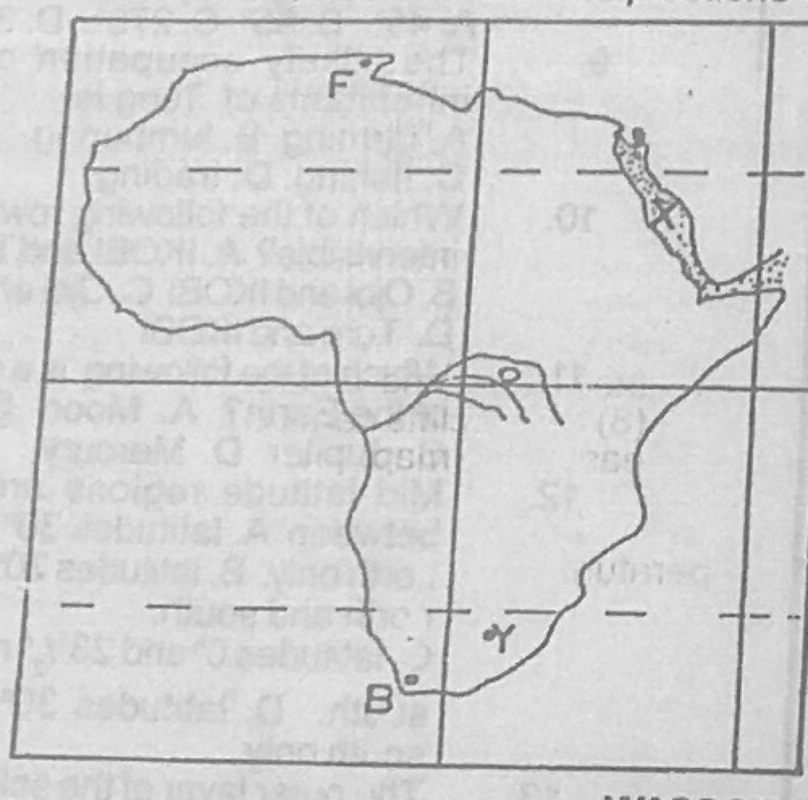
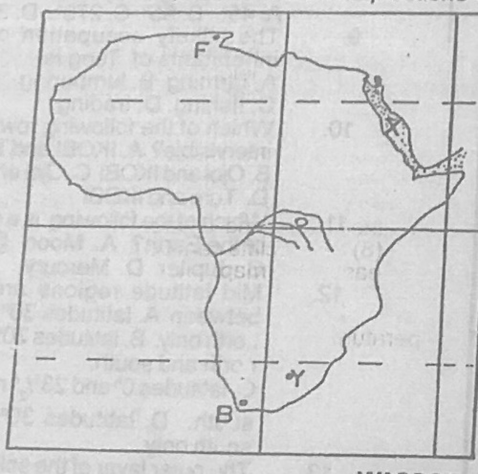
(a) Draw an outline map of Africa. On the map, locate and name: (i) longitudes 0° and 20°E; latitudes 0° and 35°S; the Atlas Mountains; (ii) one man-made lake along the river Nile. (b) Explain five ways in which African rivers are important
Show the model answer
Model answer
(a) Map: longitude 0° through Ghana and Algeria; 20°E through Libya, Chad, DR Congo and near Cape Agulhas; Equator (0°) through Gabon, Congo, DR Congo, Uganda, Kenya, Somalia; 35°S just south of the Cape; Atlas Mountains in north-west Africa; Lake Nasser (Aswan) on the Nile in Egypt/Sudan (or Sennar reservoir). (b) Hydro-electric power (Kainji, Akosombo, Aswan, Kariba); irrigation (Gezira, Nile valley, Office du Niger); transport (Congo, Niger); fishing and food; domestic and industrial water; fertile floodplains; tourism (Victoria Falls); boundaries; ports along rivers.
Describe lumbering in Zaire under the following headings: (a) favourable factors; (b) problems of exploitation; (c) contribution to the economy.
Show the model answer
Model answer
(a) Large area of equatorial rainforest in the Congo basin; valuable hardwoods (mahogany, limba, ebony, sapele); hot wet climate for fast growth; River Congo and tributaries to float logs; roads and ports (Matadi, Boma); cheap labour; local and foreign demand; foreign investment and concessions. (b) Trees of one species are scattered; dense forest and swamps make access hard; hardwoods are heavy and many sink; rapids and falls on rivers; poor roads and long distances to the coast; inadequate capital; tropical diseases; political instability; depletion of forests. (c) Government revenue; foreign exchange; employment (lumberjacks, sawmills); raw materials for sawmills, furniture, plywood and paper; timber for building, railways, bridges and boats; electric and telephone poles; growth of settlements.
Study the climatic data below and use it to answer the questions that follow. Month: J, F, M, A, M, J, J, A, S, O, N, D Temperature (°C): 21, 21, 20, 17, 15, 12, 12, 13, 14, 18, 18, 20 Rainfall (mm): 18, 17, 20, 39, 48, 90, 112, 90, 56, 47, 30, 25 (a) Calculate (i) the annual range of temperature; (ii) the mean annual temperature. (b) Use the climatic data to draw a combined rainfall and temperature graph for the station. (c) Identify the climatic type in (b) above.
Show the model answer
Model answer
(a)(i) Range = 21°C − 12°C = 9°C. (ii) Mean = (21+21+20+17+15+12+12+13+14+18+18+20) ÷ 12 = 201 ÷ 12 = 16.75°C (about 16.8°C). (b) Title; months on the horizontal axis; rainfall as bars on the left axis (mm, scale e.g. 1 cm = 20 mm); temperature as a smooth line on the right axis (°C); points plotted at mid-month; key. (c) Mediterranean (warm temperate western margin) climate of the Southern Hemisphere: warm dry summer (Dec-Feb), cool wet winter (Jun-Aug), e.g. Cape Town.
Explanation
Note the coolest months are June-July, so the station is south of the Equator.
(a) With the aid of diagram, describe the Greek system of climatic classification. (b) Identify three criticisms of the Greek system of climatic classification.
Show the model answer
Model answer
(a) The Greeks divided the earth into three zones by temperature (sun's angle/latitude): Torrid zone between the tropics (23½°N-23½°S), always hot; Temperate zones between the tropics and the polar circles (23½°-66½°) in each hemisphere, moderate; Frigid zones from the polar circles (66½°) to the poles, always cold. Diagram of a globe with the five belts labelled. (b) Based on temperature only, ignoring rainfall, pressure, winds and humidity; does not give figures (not quantitative); ignores the effect of altitude, ocean currents, continentality and relief (e.g. cold highlands in the tropics); too broad, very different climates fall in one zone; the torrid zone is not uninhabitable as they believed; boundaries rigid.
(a) Name any four planets in the solar system. (b) With the aid of appropriate diagrams, explain three proofs to show that the earth is spherical in shape.
Show the model answer
Model answer
(a) Mercury, Venus, Earth, Mars, Jupiter, Saturn, Uranus, Neptune. (b) Ship's visibility: an approaching ship shows its mast/smoke first and the hull last (diagram of curved sea surface); circular horizon that widens with height; circumnavigation: travelling continuously in one direction brings one back to the starting point (Magellan); lunar eclipse: the earth's shadow on the moon is always circular; sunrise and sunset happen at different times at different longitudes; photographs from space; other planets are spherical. Diagrams for each.
(a) With the aid of a diagram, describe the following: (i) sea breeze; (ii) land breeze. (b) State two factors that influence the salinity of oceans.
Show the model answer
Model answer
(a)(i) Sea breeze: by day the land heats faster than the sea; air over the land rises, giving low pressure; cooler air over the sea has higher pressure; cool air blows from sea to land in the afternoon; the rising air returns seawards aloft. Diagram with arrows, H over sea, L over land, sun. (ii) Land breeze: at night the land cools faster than the sea; higher pressure over land, lower over the warmer sea; air blows from land to sea at night/early morning; warm air rises over the sea. Diagram with arrows reversed. (b) Rate of evaporation (temperature, wind, humidity); amount of fresh water from rivers, rain and melting ice; degree of mixing by currents; whether the sea is enclosed or open; size of the water body.
Explanation
Show the direction of air flow with arrows on both diagrams.
(a) Define vulcanicity. (b) Describe the characteristics and mode of formation of any one of the following features: (i) dyke; (ii) composite cone. (c) In what three ways are volcanic rocks important to man?
Show the model answer
Model answer
(a) Vulcanicity is all the processes by which molten rock (magma), gases and other materials are forced into the earth's crust or onto the surface. (b) Dyke: a vertical or steeply inclined wall-like sheet of igneous rock cutting across the bedding planes; magma forces its way up a vertical crack or joint and solidifies; often harder than surrounding rock so it stands out as a ridge when exposed; e.g. Cleveland Dyke (England), Great Dyke (Zimbabwe). Composite cone: tall, symmetrical, steep-sided volcanic mountain made of alternate layers of ash/cinders and lava; built by repeated explosive and quiet eruptions; has a central vent and crater, may have secondary (parasitic) cones; e.g. Mount Cameroon, Kilimanjaro, Fuji, Vesuvius, Etna. Labelled diagram. (c) Weather into fertile soils for farming; building and road stones (granite, basalt); source of minerals (diamonds, gold, tin, copper); tourist attractions; crater lakes for water; geothermal power; grinding stones.
(a) List any four sources of water. (b) Describe any four ways in which water is useful as an environmental resource. (c) Highlight any three major problems resulting from water pollution.
Show the model answer
Model answer
(a) Rain, rivers and streams, lakes, springs, wells, boreholes, seas and oceans, reservoirs/dams, melting snow and glaciers. (b) Domestic use (drinking, cooking, washing); irrigation for agriculture; generation of hydro-electric power; transport on rivers, lakes and seas; fishing and food; industrial use (cooling, processing); recreation and tourism; habitat for aquatic life; minerals (alluvial gold, salt). (c) Death of fish and aquatic life; water-borne diseases (cholera, typhoid); shortage of clean drinking water; rapid growth of water weeds blocking waterways; loss of fishing jobs and recreation; unpleasant smell; ecological imbalance.
(a) Name any four natural hazards. (b) Highlight any three effects of air pollution on man. (c) In what three ways can air pollution be controlled?
Show the model answer
Model answer
(a) Flood, drought, earthquake, volcanic eruption, hurricane/tornado, landslide, tsunami, thunderstorm/lightning, desert encroachment. (b) Respiratory diseases (asthma, bronchitis, lung cancer); eye and skin irritation; ozone layer depletion leading to skin cancer; acid rain damaging crops, buildings and water; global warming; poor visibility causing road and air accidents; discomfort and bad smell. (c) Laws against harmful emissions; treat factory fumes (filters, scrubbers); use clean energy (solar, wind); stop gas flaring and bush burning; maintain vehicles and ban smoky ones; locate industries away from homes; afforestation; recycling instead of burning waste.