Question 8
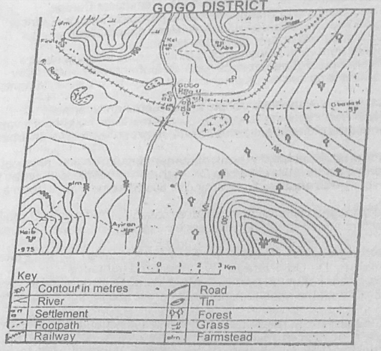
Relief and Map InterpretationUse the map of GOGO DISTRICT to answer the question. The pattern of communication lines in the map is most influenced by
- A.vegetation and climate
- B.drainage and climate
- C.relief and drainage
- D.climate and relief
- E.vegetation and drainage
Show the answer and explanation
Answer: C (relief and drainage)
Explanation
The road and railway follow the valleys between the hills and cross the river at the bridging point by Gogo.