Question 8
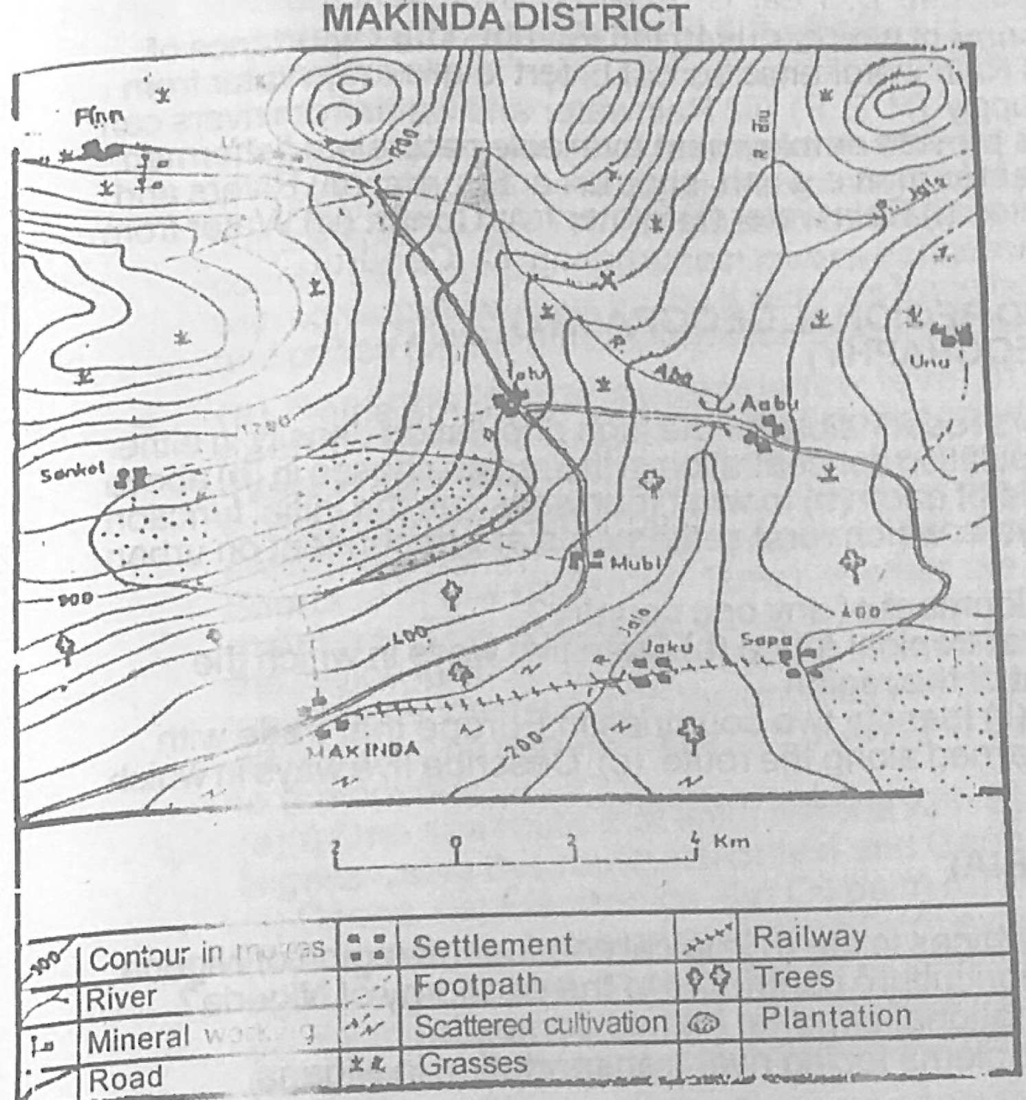
Relief and Map InterpretationUse the map of MAKINDA DISTRICT to answer the question. Which of the following drainage types can be recognised on the map?
- A.Radial
- B.Trellis
- C.Disappearing
- D.Dendritic
- E.Underground
Show the answer and explanation
Answer: D (Dendritic)
Explanation
The streams join the main rivers at acute angles in a branching, tree-like pattern: dendritic drainage.